
Natural Hazards and Disasters in India
Introduction
India have distinct geo climatic conditions due to which almost every part of India is vulnerable to natural hazards and disasters. The Earth is undergoing dynamic changes due to which the internal and external force is working on the earth. Natural hazard is an event or phenomenon that is caused by physical forces and factors occurring on the surface of the earth. When such factors occurs in a populated area, it is known as hazardous event.
Natural hazards include events caused by geological phenomenon such as earthquake, volcanic eruptions, tsunamis or meteorological phenomena such as cyclones, floods, cloud bursts etc. A disaster can only be explained in relation to a hazard. So, a disaster is a hazardous event that causes unacceptability large damage to human population, significant loss of property, interruption in social composition livelihood pattern and environmental damage.
A disaster takes place when a population is affected by hazards ( a natural physical event). For e.g. A volcanic eruption occurring on an island in Pacific Ocean can be categorized as a hazard. But when a volcanic eruption occurs near a densely populated region, it is termed as a disaster. The impact of a disaster on population is measured through the vulnerability of the population to any disaster.
Natural Hazards and Disasters in India
The magnitude of all types of natural disasters is on the rise and India is also vulnerable to the effects of these disasters. The main disasters in India are caused by earthquakes, droughts, floods, cyclones, avalanches etc.
Earthquakes in India
An earthquake is a ruthless demonstration of power of the tectonic forces caused by the endogenetic processes, originating deep inside Earth. They cause sudden vibrations and movements in the Earth’s crust. The earthquake is deep inside the Earth. The shockwaves travel in all directions from the focus and produce vibrations on the surface of Earth. The most vulnerable states include Himachal Pradesh, Jammu and The impact of a disaster on population is measured through the vulnerability of the population to any disaster Kashmir, Uttarakhand, Punjab, Haryana, Rajasthan, West Bengal, Andaman and Nicobar islands and North-East states.
Causes of Earthquakes in India
The major causes of earthquakes in India include
- Plate tectonics and plate motion, which is responsible for causing earthquakes in the younger and tectonically unstable Himalayas. Here, the states of Jammu and Kashmir, Himachal Pradesh, Uttarakhand, Nepal- Bihar Border, Assam and the zone of Indo-Gangetic plains are affected by earthquakes of high and medium intensity respectively. The Indo-Gangetic plains are severely affected even by the medium intensity earthquakes as it is a zone of high density of population.
- Intra plate faults and hydrostatic pressure, which are mainly responsible for causing earthquakes in Peninsular India. Although the peninsula is a relatively stable zone but earthquakes occur because of the presence of the faults within the Indian plate.
Earthquake Prone Areas
The earthquake prone areas of the country have been identified on the basis of scientific inputs related to seismicity and past data of earthquakes in the region. According to the latest seismic zoning map over 65% of the country is prone to ”very strong earthquakes” of intensity VII or more to the modified Mercalli scale. Following are the four seismic zones of India
- Zone V- The entire zone is in very high damage risk zone. It lies in the intensity of IX of severity of earthquakes. The entire North-East India, parts of Jammu and Kashmir, Himachal Pradesh, Rann of Kachchh, Andaman and Nicobar fall under this category.
- Zone IV- The major devastation happens to poorly designed structures. It covers remaining parts of Jammu and Kashmir, Himachal Pradesh, Delhi, Sikkim, Northern parts of Uttar Pradesh, Bihar, West Bengal, parts of Gujarat and Maharashtra
- Zone III- This zone has more severity to damage than zone II. It covers Kerala, Goa, Lakshadweep, remaining parts of U.P, Gujarat, West Bengal, parts of Punjab, Rajasthan, MP, Bihar, Jharkhand, Chhattisgarh, Odisha, Tamil Nadu and Karnataka.
- Zone II- The areas of this zone have the least risk of earthquake. All those areas include which do not fall in other zones in the country.
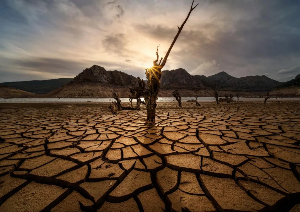
Drought in India
Drought is an event that occurs due to lower rainfall over a season or period. The primary cause of any drought is deficiency of rainfall and in particular, the timing, distribution and intensity of this deficiency in relation to the existing reserves. Drought can be devastating as water supplies dry up, crops fail to grow, animals die and malnutrition and ill health becomes widespread. Drought are divided into four types:
- Meteorological Drought: A prolonged period of less than average rainfall
- Agricultural Drought: Due to soil deficiency lack of moisture leads to the lack of croup growth and production
- Hydrological Drought: Lack of water in reservoirs, aquifers and Lakes
- Socio-economic Drought: Lack of water supply as per the demand
Causes of Droughts
Droughts occur in India mainly due to deficiency of rainfall. The major causes are:
- Early-withdrawal or late onset of South-West monsoon in India
- EL Nino events, which weakens the South-West monsoon in India
- Prolonged breaks in monsoon during the rainy the rainy season
- Depleting groundwater reservoirs, which causes hydrological droughts
- Increasing soil degradation and desertification in India due to human activities
Impacts of Drought
- Drought results in economic losses like decline in cropped area and agriculture production
- Decline in agriculture production leads to the increase of food cost
- Increase of food cost results in declining of purchasing power of people
- Due tp a prolonged period of drought widespread hunger and malnutrition occurs
- People are directly affected by drought as it results in diseases related to hunger
Drought Prone Areas of India
A drought prone area is defined as a region in which the probability of occurrence of drought in a year is greater than 20 per cent. The areas in which probability of occurrence of drought in a year is greater than 40 per cent, are classified as drought prone areas.
The following are the occurrence of drought in India:
- The desertic and semi desertic areas include Rajasthan, Haryana, Punjab and some parts of UP and Bihar.
- The dry regions lying on the leeward sides of Western Ghats, extending upto the Eastern coast of India. These regions include parts of Maharashtra, Madhya Pradesh, Odisha, Tamil Nadu, Andhra Pradesh Telangana etc.
- Isolated pockets of drought prone areas include Saurashtra. Kachchh region, Jhansi, Palamau, Purulia, Kalahandi, Udhampur etc.
Floods in India
A flood is an overflow of water of a river channel or on a coast that leads to submergence of nearby land. A flood can be caused by either heavy rainfall or adequate, constricted drainage. Human factors like deforestation, poor agricultural practices, situation of dams, rivers also cause floods the cause huge damage. Floods are becoming more intense and frequent due to climate change and so they have the potential to damage to public properties, crop loss material loss fierce effects on human health.
Major Causes of Floods
Floods are generally caused by adverse meteorological or physical factors and are aggravated by human factors. These factors are described below:
- Floods are caused by meteorological conditions such as heavy rainfall, cyclones, cloud bursts, melting of snow, tsunamis etc.
- Physical factors such as large catchment area of rivers, inadequate drainage, landslides, situation of river beds cause flooding.
- Human factors which intensify the effects of floods are deforestation, poor agriculture practices, faulty dams, accelerated urbanization, loss of vegetation cover etc.
Impacts of Floods
In India, floods cause huge damage to lives, property and infrastructure. These are the major impacts of floods in India:
- Loss of human lives and death of animals
- Migration of Humans as well as animals from their destroyed habitats to safer places
- Submergence of crops, loss of livelihood and destruction and damage to property and disruption of life
- Floods leads to the outbreak of epidemics like diarrhoea, malaria and cause deaths.
Flood Prone Areas of India
The flood prone areas in India are as follows:
- Ganga River and its Tributaries: Ganga along with its tributaries forms one of the largest drainage areas of the world. UP and Bihar are the worst affected stated and account for over one third of flood prone areas of India
- Brahmaputra Basin: The river banks of Brahmaputra cause flood cause floods in Assam, Arunachal Pradesh, Nagaland and Manipur.
- Central India and Deccan Rivers: Central Indian and Southern rivers such as Narmada, Tapi, Krishna, Kaveri cause floods in the states of Gujarat, Madhya Pradesh, Andhra Pradesh, Karnataka, Telangana, Tamil Nadu.
- Tropical Cyclones: Tropical Cyclones storms on the East coast of India severely affect the states of Andhra Pradesh, Tamil Nadu, Odisha and even Maharashtra.
- Cloudburst: Cloudbursts are extreme events of very high precipitation caused due to a thunderstorm. Rainfall of generally 100 mm or greater occur in an hour during a cloudburst
Tropical Cyclones in India
Tropical cyclones are low pressure systems in which the air pressure systems in which the air pressure increases from the center to the outer areas. A cyclone is formed sue to the Coriolis force and rapid inward circulation to low pressure zone. India has a long coastline of 7516.6 km where it is exposed to around 10% cyclones of the world.
Causes of Tropical Cyclone in India
There are two definite seasons of occurrence of tropical in India. One is from May to June tropical cyclones in India. One of is from May to June and the other is from mid-September to mid- December. The months of May-June and September-December are the periods of transition of seasons in India. The overhead mid day sun lies above the tropical Indian ocean during the transition months. During this period, the ITCZ shifts over the tropical Indian period, the ITCZ shifts over the tropical Indian ocean. This shift of ITCZ creates low pressure over the Indian-ocean due to the heating of the ocean surface.
Distribution of Tropical Cyclones in India
About 80% of tropical cyclones occur in the Bay of Bengal. This is because the Bay of Bengal has relatively higher temperatures as it is surrounded by lands from three sides as compared to the Arabian sea. The Bay of Bengal has no cold current unlike the Arabian sea which is by cold small current. These cyclones mainly affect the East coast of India. The Eastern coastal states of Andhra Pradesh, Odisha and Tamil Nadu are worst affected.
Himalayan Hazards and Disasters (Natural Hazards and Disasters in India)
The ongoing plates has generated the Himalayas. The Himalayan Mountain ranges are located along a huge set of faults which is the point of accumulation of huge amount of energy which can release suddenly and result into a big disaster. This fault has already generated 2015 earthquake in Nepal. This earthquake trigger landslides in the Himalayan Highlands. Also , flash floods are a regular occurrence in the Himalayas.
Landslides
Landslides are very common along the steep slopes of the Himalayas, the Western Ghats and along the river valleys. Landslide as a hazard has long been recognized by the people living in the mountains which are affected the most landslides. The extent of landslides depends on the steepness of the slopes, the bedding plane of rocks, the amount of flora on the mountains, the geological structure.
The two regions most vulnerable to landslides are the Himalayas and the Western Ghats. The younger geological formations subjected to severe seismic activity. The Western Ghats and Nilgiri hills are geologically stable but the uplifted plate margins influenced by the neo-tectonic activity.
Major natural Causes of Landslides
- Weak, sensitive or weathered materials, adverse ground structure, physical property variation
- Ground uplift, erosion, deposition loading in the slope crust, vegetation removal
- Prolonged precipitation, earthquake, volcanic eruption, shrink and swell of rocks
The man-made causes are
- Excavation, unregulated irrigation unplanned mining,
- artificial vibrations, water constriction and
- leakage from utilities
Impact of Landslides
The types of landslides in the Himalayas include block fall, slump fall, debris fall, rock fall and slumping. The pressure of population and the economic exploitation of the mountain region have been a major cause of landslides and this causes immense damage to lives and property.
Landslides prone areas
The two most vulnerable regions in India are the Himalayas and the Western Ghats. The landslide prone areas also include North-East hills, Eastern Ghats, Vindhyachal but vulnerability here is relatively low as compared to the Himalayas and Western Ghats. The landslides vulnerabilities varies from high to very high in the Himalayas, high in North-East hills and Western Ghats, moderate moderate in Nilgiri hills, Eastern Ghats and low in Vindhyachal.
Avalanches
The term avalanche generally refers to the downslide of material on a mountain slope. It is specifically the sliding down of a mass of snow compounded with ice and rock. The people of the Western Himalayan region are greatly affected by the presence of the mountains and the snow they contain, in terms of economic concerns, transport through the region to the rest of the country. Avalanche affect the Himalayan regions fall under Debris avalanches and rock avalanche.
Causes of Avalanches
- Heavy snowstorms are more likely to cause avalanches
- Heavy snowfall deposits snow in unstable areas and puts pressure on the snowpack.
- In recent years, human have contributed which puts pressure on the snow pack.
- The use of terrain vehicles and snow mobiles creates vibrations on the snow which may cause avalanche.
Avalanche Prone Areas
The higher snow range of the Himalayas are prone to avalanches. The higher range of western Himalayas includes Jammu and Kashmir, Himachal Pradesh and Uttarakhand are prone to avalanches.
- Jammu and Kashmir- Higher reaches of Kashmir and Guerz valleys, kargil and Ladakh are some of the major regions prone to landslides
- Himachal Pradesh- Chambal, Kullu-Spiti and Kinnaur are vulnerable areas.
- Uttarakhand- Parts of Tehri Garhwal and Chamoli districts are vulnerable areas.
Measures to cope for Disasters
The methods to cope up with the disasters are:
- Awareness- There is a general unawareness among people and it is important to generate awareness with necessary safety and rescue measures.
- Hazard mapping- By using the hazard map which includes all the information on all types of hazards
- Training- For safety and rescue methods would go a long way to bring down the avalanche casualties
- Telecasting- Regular programmes of public interest on hazard safety and rescue methods
- Forecasting- Mitigation through forecasting is y far the best and the cheapest method.