
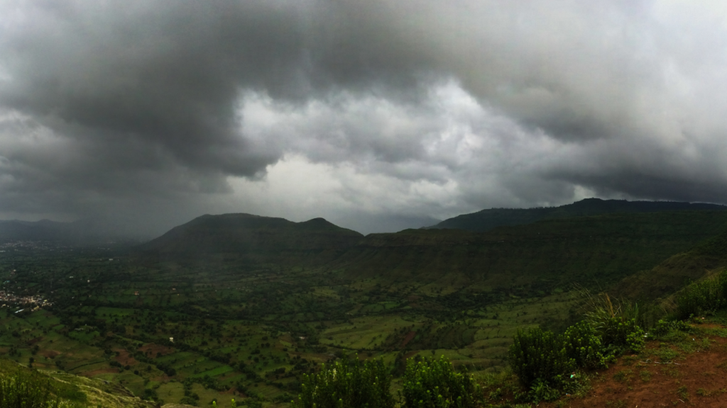
Monsoon and Jet Stream
Monsoon represents one of the crucial phenomena in the category of secondary circulation of the atmosphere. In meteorology, monsoon signifies the directional shifting of winds from one season to the other monsoon circulation involves a change of 180 degrees in the direction of wind.
Originally the meaning of monsoon was applied concerning what is today known as monsoon Asia. Undoubtedly it is this part of the earth where monsoon circulation is found in the ideal form. There are other continents such as the United States of America and Northern Australia, West Africa where only pseudo-monsoon or monsoon tendencies are to be observed.
CONCEPT OF ORIGIN OF MONSOON
Thermal Concept
It was Hailey who propounded the thermal concept of the origin of the Asiatic monsoon in a memoir presented to the Royal Society in 1686. This theory was, however, applied to all continental regions besides Asia. According to it, the monsoons are considered to be gigantic convectional systems produced by differential seasonal heating of continental and oceanic areas. Monsoons are more than just seasonal winds and are also directly thermally induced. Thus, the origin of Asiatic may be ascribed to the thermal differences between land and sea.
During winter the huge landmass of Asia cools more rapidly than the surrounding oceans with the result that a strong high pressure Centre develops over the continent. On the other hand, the pressure over adjacent oceans is relatively lower. As a result, the pressure gradient is directed from land to sea. Therefore there is an outflow of air from the continental landmass towards the adjacent oceans that brings cold dry air towards the low latitude.
In summer the temperature and pressure conditions are reversed. Now the huge landmass of Asia heats quickly and deserves a strong low-pressure centre. Moreover, the poleward shift of the Intertropical Convergence Zone to a position over Southern Asia reinforces the thermally induced low-pressure centre. The pressure over the adjacent oceans being high, a sea-to-land pressure gradient is established. The surface air flow is, therefore from the highs over the oceans towards the lows over the heated land.
Aerological Concept
If the seasonal reversal of prevailing winds were the sole criterion of the monsoon circulation, then the seasonal variation of winds aloft would entitle them to be called the upper air monsoon or simply the aerological monsoon.
Flohn’s concept
According to Flohn, monsoon is only the normal seasonal migration of planetary wind following the sun. It is because of the normal swing of the planetary circulation zones that there is a periodical change of wind direction in the lower and upper levels of the atmosphere. During the northern summer, all the wind is displaced towards the north, while during the northern winter, it shifts towards the south following the apparent movement of the sun in its zenith.
Flohn ascribes the origin of monsoon to the thermal response of the tropical continental atmosphere and the annual variation of solar radiation. However, he seems to have ignored the upper atmospheric circulation which makes the Asiatic monsoon a fairly complex system.
STAGES OF MONSOON
Several changes occur in the circulation of the atmosphere when the summer monsoon sets in over India. The main features are:
The heat low: As the moves northwards across the equator in the northern hemisphere the continents surrounding the Arabian Sea begin to receive large amounts of heat, not only in the form of radiation from the sun but also as heat emitted from the earth’s surface.
Near equatorial troughs and the Mascarenes High: Before the onset of the summer monsoon over India, a low-pressure zone forms on either side of the equator, roughly along 5 degrees N and 5 degrees S. Meteorologists refer to this as an equatorial double trough.
It has been suggested that the onset of the monsoon is related to a sudden acceleration of air from the southern hemisphere towards India across the equator. The southern hemispherical circulation of the monsoon regime is dominated by an anticyclonic circulation, around a region of high pressure, of the coast of Madagascar. This is the Mascarenes high around which the winds blow in an anti clockwise direction
Sub-tropical westerly and tropical easterly jet streams: There are equally interesting changes that take place in the upper atmosphere with the advent of the summer monsoon. Towards the end of May, a narrow stream of air, which moves from the west to the east over northern India, suddenly weakens and moves to a new location far to the north is one of the main features associated with the monsoon’s onset over India.
As the westerly jet moves north, yet another jet stream sets in over the southern half of the Indian peninsula. This flows in the reverse direction from the east to the west. It is called the tropical easterly jet, and it exhibits periodic movements o the north and south of its mean location during the hundred day monsoon season beginning with he first of June and ending around mid September.
The Tibetan high: The Tibetan High is a dominant feature which is related to the monsoon’s over the plateau of Tibet. The reasons for the formation of the high are not very well understand at present. The average height of the plateau is around 4 km, which corresponds to a pressure of about 600 hPa. This is nearly half the depth of the troposphere.
Change in Kinetic energy: A number of studies are now beginning to emerge which seek to quantify the energetics of the monsoon circulation. These studies have received considerable impetus from international data collection programmes.
The withdrawal of the monsoon
The change from a summer to a winter type of circulation with the retreat of the sun to the south of the equator is of shorter duration than the reversal from inter to summer. it is much more gradual than the abrupt changes associated with the onset of the summer monsoon. The monsoon begins to withdraw from northern India around mid-September. By the end of October it has usually withdrawn from the region north 15 degree N and from Bangladesh and Burma. Finally, it withdrawn from the extremes south of the Indian peninsula and Sri Lanka by December.
JET STREAM
The jet streams are defined as swift geostrophic air streams in the upper troposphere that meander relatively narrow belts. These are strong cores of upper level westerly winds which follow a meandering or swirling path. The ‘jet stream’ was first applied to the high velocity upper level winds during World War II. Since then they are becoming increasingly important to persons interested in upper air currents and that possible impact upon surface weather conditions. They have assumed still greater significance to high flying jets.
Jet streams are characterized by a great seasonal variation. During the colder of the year they migrate towards the equator and their velocity also increases. In summer the wind spends in jet streams are reduced to about half of what is in winter because of smaller horizontal temperature gradients. In winter, the jet streams extend far into the tropics.
Index Cycle of the Jet Stream
Stages
Pressure gradient systems in this stage have east west orientation. North south pressure gradient is relatively steeper. The air mass exchanges between the temperature and tropical regions is at its minimum. The first stage thus represents the high zonal index.
In the second stage the amplitude of jet stream waves increases. The whole of the jet moves towards the equator as a result of which there is an in road of cold polar air southward. The warm air masses from lower latitudes move towards higher latitudes.
In the third stage the bends in the jet stream become sharper and the amplitude of weaves registers further increase. At this stage the tropical air mass move further north and cold polar air moves farther south. The temperature gradient directed from east to west.
In the last stage of index cycle, the giant size meanders of the jet are cut off from the main stream. The result is an immense pool of cold air is encircled by entirely different air masses. In the upper atmosphere of high latitudes the tropical air masses are entrapped by colder air. This is called the low zonal index of the jet stream. The zonal character of upper level westerlies is no longer in existence.
Jet Stream and surface water
The jet stream is said to play a very significant role in controlling the behavior of terrestrial atmosphere. It is true that there is a close relationship between the jet stream and surface weather. Now it is established fact that the polar front jet streams are closely related to the middle latitude weather disturbances. The meanders of the more northerly upper tropospheric jet stream determine the location od the surface polar front. The jet stream also play an important role in the movement of different air masses which may produce a prolonged period of drought of flood.